


|

|
|
|
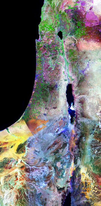
HolyLand
This image shows all of Israel from Mount Hermon and the Golan Heights in the north to
Eilat on the Gulf of Aqaba in the south, including the Sea of Galilee, the Jordan River,
the Dead Sea, and portions of Lebanon, Syria, Jordan and the Sinai that surround Israel.
The city of Jerusalem stands out prominently near the center of the image, with the Old City
a lighter color embedded within modern Jerusalem. The streets of Tel Aviv are visible here as
are the many farms and settlements that are present throughout this region. The spectacular
colors of the Negev are due to differences in the mineral composition of the sand and rocks
located there. The distinctive border between Egypt and Israel is a consequence of land-use
differences. The Jordanian side of the Jordan River includes Amman, Mt. Nebo, Petra, and Wadi
Rum.
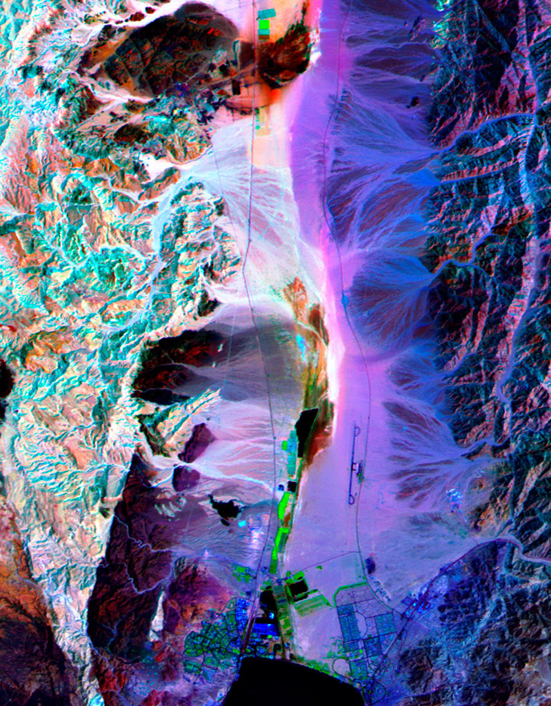
The area covered by this image is approximately 153x312 miles. A full-resolution
crop of the image is available
here that shows
the detail present in the full image. This detail contains the lower portion of the
Jordan Rift Valley and Eilat on the Gulf of Aqaba. Deep red pixels at the top of the cropped
image are effluent from copper mines that date to King Solomon.
These images are printed on the highest quality paper using archival pigment inks. The larger size
is a limited edition print with edition size 50. These prints give dramatic, colorful, and detailed
displays of this historic region.
Special pricing applies to prints of this image:
16x32: $250 unframed
24x48 Limited Edition, unframed with certificate of authenticity: $1800
|
|
|
|
|
|
|